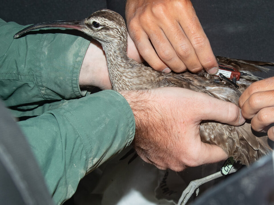
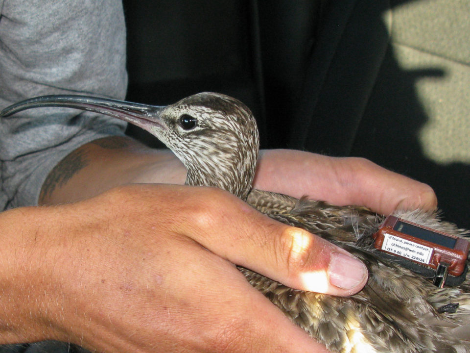
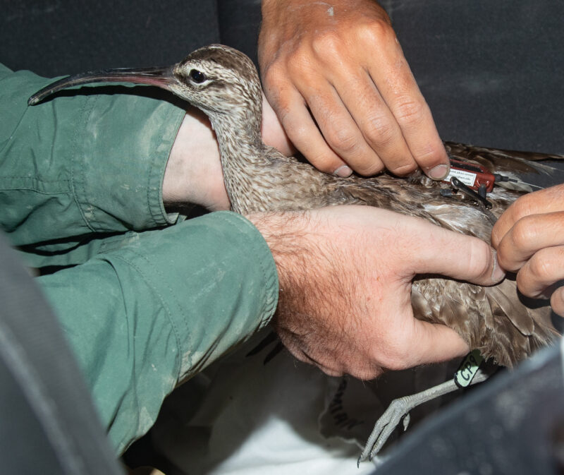
By: Chance Hines9/30/25 Whimbrels hold a special place in CCB’s history. As one of the larger migratory shorebirds, they’ve long been a focus of tracking projects […]
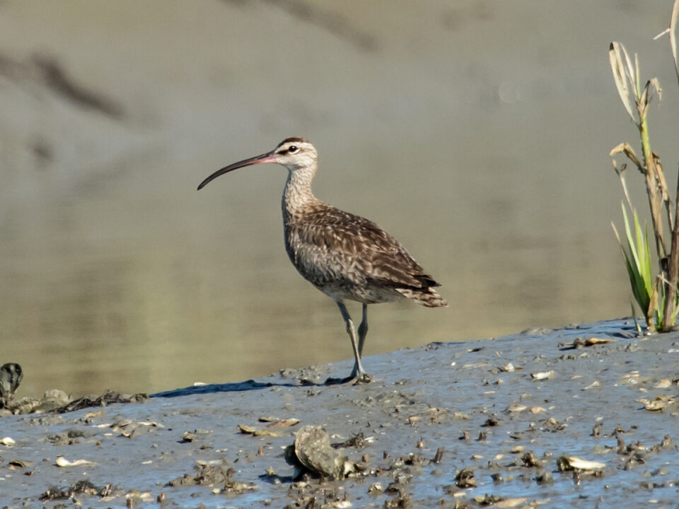
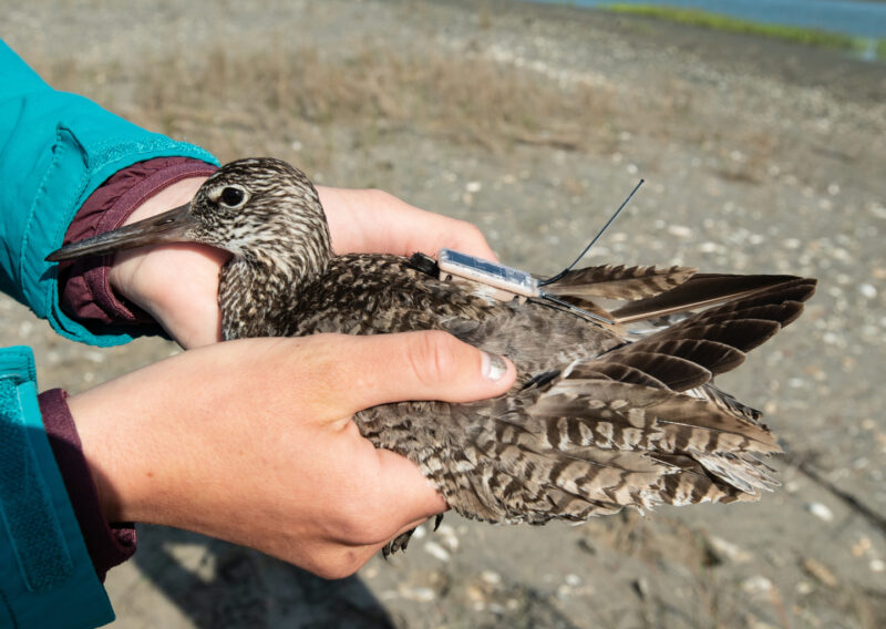
By: Bryan Watts4/2/2025 The whimbrel is a large shorebird that is capable of extreme flight distances during migrations but utilizes relatively few refueling sites. The Delmarva […]
By: Bryan Watts1/24/2025 An eastern willet fitted with a transmitter on the breeding grounds in Virginia was shot within one of the famous “shooting swamps” on […]
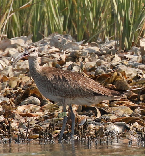
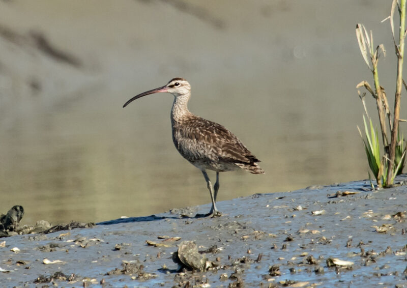
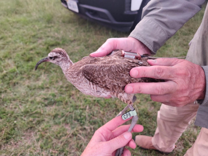
Among the many bird species that CCB has researched in the name of conservation is the whimbrel, a large, brown shorebird known for its distinctively downcurved […]
By: Chance Hines10/5/23 While temperatures outside continue soaring, the shortening days and falling leaves remind us that autumn is nearing. This time of year also finds […]
By: Bryan Watts10/5/22 CCB has formed a collaborative with Dominion Energy and The Nature Conservancy to better understand the risks posed by offshore wind facilities to […]
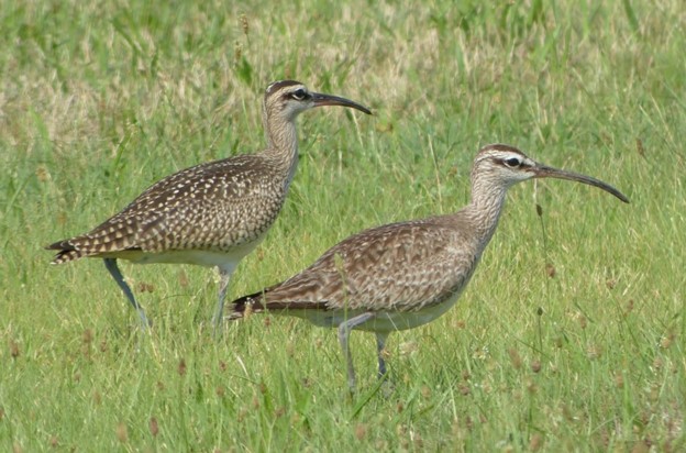
By Bryan Watts1/13/2022 When Barry Truitt and I first established and flew aerial transects across the seaside of the lower Delmarva to survey staging whimbrels in […]
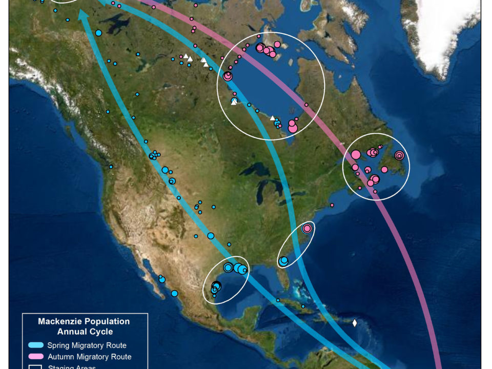
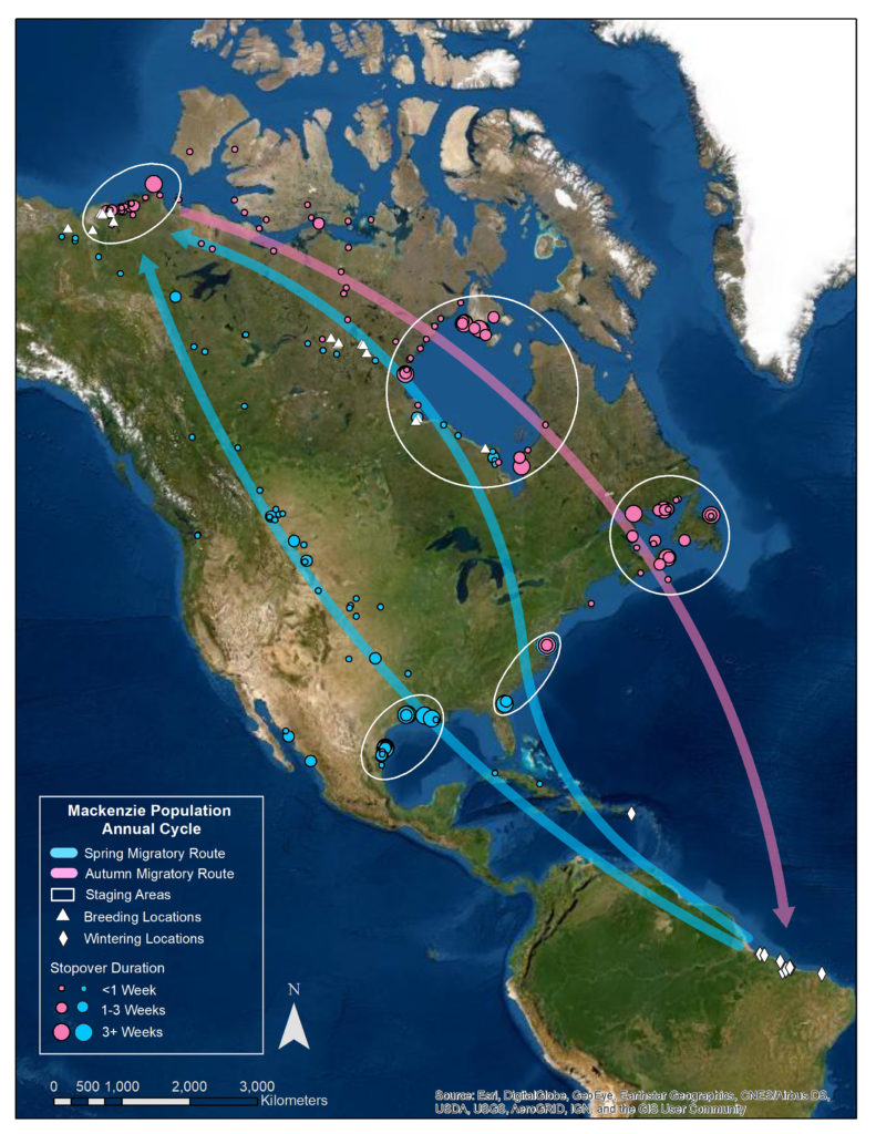
By Bryan Watts10/3/2021 Whimbrel populations (Hudson Bay, Mackenzie River) that utilize the Western Atlantic Flyway are believed to be declining by 4% annually since at least […]
The question(s) of the week is “where is Azalea?” and more specifically “where is that satellite map you promised??) The latest data about 7am Aug 24 […]
Hope finally came to rest on the southern shore of St. Croix in the U.S. Virgin Islands on friday evening August 15 after flying non-stop from Hudson Bay […]

