Center for Conservation Biology
- Filter by
- Categories
- Tags
- Authors
- Show all
- All
- Conservation Stories
- Eagle Nest Blog
- EagleTrak Blog
- News Story
- OspreyTrak Blog
- Photo Essays
- Press Release
- Uncategorized
- All
- 'Azalea' (HH)
- 'Camellia' (NC)
- 'Conowingo' (eagle)
- 'love branch'
- 'Machipongo' (eagle)
- 'Pioneer' (eagle)
- 'the dump'
- 2-weeks-old
- 2008 camera tree
- 3-chick brood
- academic literature
- Adner
- Adner Swamp
- age
- airport
- Alanton
- Albemarle & Chesapeake Canal
- Albemarle Sound
- Alfonso
- Alligator River
- Alligator River NWR
- Allmondsville
- alphanumeric resight band
- aluminum band
- American kestrel
- animal behavior
- Ann Shirley
- Annual Report
- associate
- Aulander
- avian flu
- avian pox
- award
- Back Bay
- Back Bay NWR
- bald eagle
- banders
- Banding
- Barhamsville
- barn owl
- Bayside
- Beaufort Sea
- Belhaven
- Belleville Creek
- Berkley Island
- Bertie Co NC
- Big Bethel Recreation Area
- Big Bethel Reservoir
- Big Bethel Road
- Birds Eggs by Michael Walters
- black rail
- Blackwater
- Blackwells
- Bobbi Monaghan
- body size
- borrow pit
- Bowling Green
- branching
- breeding
- breeding pair
- Broad Bay
- Broadus Corner
- brood size
- Bryan D. Watts Ph.D.
- Bryan Watts
- Bumpass
- Burden
- Burgess
- Busch Gardens
- Butler Lake
- Caledon Natural Area
- Camden Co NC
- camera tree
- Cameron Hills Golf Course
- Camp Peary
- Canada
- Canada goose
- canal
- Capron
- carnivorous
- Caroline Co
- Cary Lynch
- catfish
- catfish ponds
- cattle grazing land
- Center for Conservation Biology (CCB)
- Center for Conservation Biology (CCB)
- Central Point
- Charles City Co
- Chesapeake
- Chesapeake Bay
- Chesapeake Beach
- Chesterfield Co
- Chickahominy River
- Chippokes Plantation
- Chowan Co NC
- Chowan River
- Chuckatuck Creek
- Claremont
- cliffs
- climate change
- close-up
- clutch size
- Coan River
- Coastal Virginia Wildlife Observatory (CVWO)
- Cobb Island
- Coinjock
- Coldwater
- Coleman Creek
- College Creek
- College of William & Mary
- College Park
- Colonial Beach
- Colonial National Historic Parkway
- colonial waterbirds
- Columbia
- common raven
- communal roost
- Conowingo
- conservation research
- Coopers hawk
- copulation
- Cornell Laboratory of Ornithology
- Corrotoman River
- Courtland
- Craney Island
- Crittenden
- Croaker
- crop
- Currituck Co NC
- Daniel Corner
- Dare Co NC
- DDT
- deer carcass
- defending territory
- defensive behavior
- Delaware
- development
- diagram
- diet
- digestive tract
- Dinwiddie Co
- dispersal
- distance
- disturbance
- diurnal
- diurnal vs nocturnal
- Dividing Creek
- Dogue
- Dogue Run
- DogueHop Yard Landing
- Dominion Virginia Power
- double-crested cormorant
- down feathers
- Dr Mitchell Byrd
- Dr. Ruth McQueen
- Dragon Swamp
- Duane Noblick
- Durants Neck
- eagle concentration area
- eagle eyes
- eagle release
- eagle research
- eagle survey
- eaglet
- EagleTrak
- EagleTrak Naming Contest
- ears
- East Lake
- East Pembroke
- Eastern Shore
- Eastern Shore of Va
- ecology
- Edenton
- Edwardsville
- egg
- egg hatching
- egg laying
- egg size
- egg tooth
- eggshell
- Elizabeth City
- Elizabeth River
- Elmwood
- embryo
- Endangered Species Act
- eNewsletter Photo Gallery
- Enfield
- Engelhard
- esophagus
- Essex Co
- ethology
- European kestrel
- exposure
- Fair Port
- familial recognition
- feather molt
- feather tracts
- feathers
- feeding
- female
- field techniques
- first flight
- First Landing St Pk
- fish
- fish eagle
- Fledging
- Fleets Island
- flight
- Florida
- Food/Feeding
- Fort A.P. Hill
- Fort Landing
- Fort Story
- Franklin
- Franklin Co
- Fredericksburg
- Friendship Pond
- fruit
- Gates Co NC
- gender manipulation
- gender patterns
- generalist predator
- Gera
- Glenns
- Gloucester
- Gloucester Co
- Gloucester Point
- golf course
- Goochland Co
- Good Luck
- Goose Island
- Gordonsville
- Gourd Neck Road
- GPS data
- GPS locations
- Grafton
- Great Bridge
- Great Dismal Swamp NWR
- great horned owl
- Great Neck
- Great Wicomico River
- Greenville Co
- Greenwich Mean Time (GMT)
- growth rate
- Guilford Heights
- gull
- habitat
- habituate
- Hack Creek
- Halifax Co
- Hampton
- Hampton Roads
- Hampton Roads Harbor
- Hancock
- Hanover Co
- Hartfield
- Hartford Co MD
- Harwoods Mill Reservoir
- hatching
- hatching muscle
- hatchling
- Hawk Ridge Bird Observatory (HRBO)
- Hawk Watch
- HE
- hearing
- Heathsville
- Henslow's Sparrow
- Hertford
- Hertford Co
- HK
- Hog Island
- hope
- Hopewell
- Horn Harbor
- Howland
- Hudson Bay
- Hull Creek
- Hyde
- Hyde Co NC
- I-64
- I-95
- immature
- imprint
- Incubating
- independence
- Independence Blvd
- injury
- innate
- instinct
- instinctive behavior
- insulation
- Intracoastal Waterway
- Ipswich sparrow
- Irvington
- Isle of Wight Co
- James City Co
- James River
- Jamestown Island
- Jamestown-Scoland Ferry
- Jan Reese
- Jerdone Island
- Jim Deal
- Joe Foreman
- Jones Creek
- Jordan Point
- juvenile
- Keith Cline
- Kempsville
- Kilmarnock
- King & Queen Co
- King & Queen County Landfill
- King George
- King George Co
- King George Landfill
- King William Co
- Kings Highway
- Kiptopeke State Park
- Lake Anna
- Lake Anna Marina
- Lake Anna State Park
- Lake Drummond
- Lake Edwards
- Lake Lawson
- Lake Mattamuskeet
- Lake Smith
- Lake Whitehurst
- Lakeview Park
- Lancaster
- Lancaster Co
- Lancaster Creek
- landfill
- laughing gull
- Laura Erickson
- Layton
- learn
- Leedstown
- Lesner Bridge
- Lewisetta
- Libby Mojica
- Liberty Fork
- Lilian
- Lisa Barlow
- Listers Corner
- Little Creek
- Little Creek Naval Amphibious Base
- Little Creek Reservoir
- Little Neck
- Little Plymouth
- Little River
- Little Wicomico River
- Litwalton
- Lively
- Lone Star Lakes Recreation Area
- Loretto
- Lost Lake
- Louisa Co
- lower Chesapeake Bay
- Luttrels Corner
- Lynnhaven River
- Machipongo
- Mackay Island NWR
- MacKenzie River
- Mackeys
- Maine
- male
- Manns Harbor NC
- map
- map key
- Marian Watts
- marsh
- Maryland
- Mascot
- Mason Creek
- Mataponi River
- Mathews
- Mathews Co
- Mattamuskeet NWR
- Mattaponi River
- Meherrin River
- meiosis
- menhaden
- Merry Hill
- Middle Peninsula
- Middle Peninsula Landfill
- Middlesex Co
- Midway Veterinary Hospital
- migration
- Milbank
- Mill Creek
- Mitchell Byrd
- Montague
- Moores Mill
- Morattico
- Mount Olive
- Muddy Creek
- muskrat
- Nansemond River
- Nash Town
- natal territory
- NATO Tower
- Naulakla
- NC Game Commission
- ND
- NE
- nest guarding
- nest lining
- nest tree
- nestcam
- Nesting (town of)
- New Holland
- New Kent Co
- New York
- Newmans Creek
- Newport News
- Newport News Park
- Newport News-Williamsburg Airport
- nightjars
- Norfolk
- Norfolk Botanical Garden (NBG)
- Norfolk Harbor
- North Carolina
- North Landing River
- North River
- Northern flicker
- northern goshawk
- Northern Neck
- Northumberland Co
- Northwest River
- Nottoway River
- Nuckols Tree Care
- Nunavut CAN
- NWR
- Ocean View
- offshore wind
- online course
- Ophelia
- Orange Co
- Ornithology by Frank B. Gill
- osprey
- ospreywatch
- oviparous
- pair
- Pamlico Sound
- Pamunkey River
- Pasquotank Co NC
- Pasquotank River
- PBS
- Pembroke
- Pennsylvania
- peregrine falcon
- Perquimans Co NC
- Perquimans River
- Perrin
- Perrin Creek
- Petersburg
- Phoebus
- photo
- Piankatank River
- pine straw
- Pinetta
- pipping
- Plum Tree NWR
- plumage
- plumulaceous
- Plymouth
- pocosin
- policy
- Poquoson
- Poropotank River
- Port Conway
- Port Royal
- Portobago
- Portsmouth
- Potomac Mills
- Potomac River
- power line
- Powhatan Airport
- preen/uropygial gland
- preening
- Presley Creek
- press
- prey
- prey item
- Prince George Co
- productivity
- publications
- Purkins Corner
- quarry
- Queen County Landfill
- Queens Creek
- Queens Lake
- raccoon
- range expansion
- Rappahannock River
- raptor
- red-bellied woodpecker
- red-cockaded woodpecker
- Reedville
- Reese Lukei Jr
- reference article
- reference link
- reproductive success
- Richmond
- Richmond Co
- Roanoke River
- Robbies Island
- Rollins Fork
- roost
- roost tree
- Roper
- Rose Garden
- royal tern
- Rt-17
- Rt-199
- Rt-208
- Rt-264
- Rt-604
- Rt-64
- Rt-94
- runway
- Sajo Farms
- salinity
- Salmon Creek
- saltmarsh sparrow
- Saluda
- Saluda Landfill
- Samuels Corner
- Sassafras
- satellite tracking
- satellite transmitter
- Sawyer Lake
- schedule
- ScholarWorks
- Scotland Neck
- sea eagle
- sea-level rise
- seagull
- Sealston
- sexually dimorphic
- sharp-shinned hawk
- Shawboro
- Shawn Padgett
- Shelly Fowler
- Skinkers Corner
- Smithfield
- Smiths Point
- snow
- solar battery
- song sparrow
- South Carolina
- South Lake
- Southampton Co
- sparring
- Sparta
- Spotsylvania Co
- St Croix USVI
- St Mary's Co
- Stephen Living (DGIF)
- storm
- striped bass
- Stumpy Lake
- Suffolk
- Sunken Meadow Creek
- Supply
- Surry Co
- survival skills
- Sydnors Millpond
- Tappahannock
- Tarboro NC
- tarsus
- Tettington
- thermal
- thermal system
- Thoroughgood
- Thurman Isl
- Tidewater Research Station
- Tignor
- tilapia
- timeline
- Tippers
- Toano
- Totuskey Creek
- tracking
- Trail Camera
- translocation
- trout
- Tulls Bay
- Tyrell Co NC
- Upper Peninsula
- Urbanna
- US-17
- US-301
- USVI
- VDGIF
- video link
- Vir-Mar
- Vir-Mar Beach
- Virginia
- Virginia Beach
- Virginia's Eastern Shore
- vision
- visual identity
- Wards Corner
- Ware Neck
- Warner
- Warsaw
- Washington Co NC
- Water View
- waterfowl
- waterproof
- Waupoppin Canal
- waxy secretion
- Wayne's Warbler
- webcam feed status
- Weems
- West Point
- Westmoreland Co
- whimbrel
- Whipping Creek Lake
- White Stone
- Whites Corner
- Whites Lake
- whitewash
- WHRO
- Wicomico Church
- Wicomico River
- Wildlife Center of VA
- Wildlife Center of Virginia
- WildlifeTracking.org
- willet
- Williamsburg
- Wilmot
- wind energy
- Windmill Pt
- Windsor
- wing exercise
- Winton
- Wise Point
- Wishart Road
- Witchduck
- Witchduck Point
- Witchduck Road
- wooded swamp
- WVEC
- yellow perch
- yellow-crowned night heron
- York Co
- York River
- York River St Pk
- Yorktown
- Yukon
October 5, 2009
Published by Center for Conservation Biology at October 5, 2009
Categories
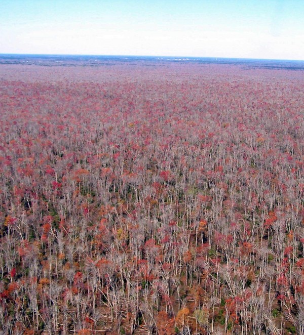
Azalea has returned to the landfill in King and Queen County, VA. CCB has documented other transmittered eagles using this site to forage and roost. She’s […]
Do you like it?
October 5, 2009
Published by Center for Conservation Biology at October 5, 2009
Categories
Azalea has returned to the landfill in King and Queen County, VA. CCB has documented other transmittered eagles using this site to forage and roost. She’s […]
Do you like it?
October 4, 2009
Published by Center for Conservation Biology at October 4, 2009
Categories
So, just where are the bald eagles that have been fitted with satellite transmitters by The Center for Conservation Biology? In addition to Azalea from the […]
Do you like it?
October 2, 2009
Published by Center for Conservation Biology at October 2, 2009
Categories
I don’t have an updated map yet, but it appears that Azalea has returned to the King & Queen County landfill. I will post a new […]
Do you like it?
October 2, 2009
Published by Center for Conservation Biology at October 2, 2009
Categories
I don’t have an updated map yet, but it appears that Azalea has returned to the King & Queen County landfill. I will post a new […]
Do you like it?
September 28, 2009
Published by Center for Conservation Biology at September 28, 2009
Categories
After all the to do about the King and Queen County landfill, Azalea only stayed there about 2 hours then flew right back to what has […]
Do you like it?
September 26, 2009
Published by Center for Conservation Biology at September 26, 2009
Categories
I do not yet have a detailed map to post, but this is to update you as to Azalea’s location. She did not stay at the […]
Do you like it?
September 21, 2009
Published by Center for Conservation Biology at September 21, 2009
Categories
On Thursday Sept 17 on our last map, Azalea was within a couple hundred yards of the Potomac River near the entrance of Newman’s Creek. Later […]
Do you like it?
September 18, 2009
Published by Center for Conservation Biology at September 18, 2009
Categories
On Monday Sept 14 Azalea had discovered Hack Creek which is just west of Vir-Mar Beach, VA. She only stayed there an hour or so then […]
Do you like it?
September 14, 2009
Published by Center for Conservation Biology at September 14, 2009
Categories
Do you like it?
September 14, 2009
Published by Center for Conservation Biology at September 14, 2009
Categories
Azalea continued to wander around in Northumberland County, and returned to locations she has been to before, plus one new creek. On Friday afternoon Sept 11 she […]
Do you like it?
September 13, 2009
Published by Center for Conservation Biology at September 13, 2009
Categories
Do you like it?
September 13, 2009
Published by Center for Conservation Biology at September 13, 2009
Categories
Do you like it?
September 13, 2009
Published by Center for Conservation Biology at September 13, 2009
Categories
Azalea has been exploring again. She spent the day of Tuesday Sept 8 around the Rappahannock River east of Layton, VA and spent the night Sept […]
Do you like it?
September 12, 2009
Published by Center for Conservation Biology at September 12, 2009
Categories
Do you like it?
September 12, 2009
Published by Center for Conservation Biology at September 12, 2009
Categories
I do not yet have the data to post a detailed map of the past few days, but so you know, Azalea has returned to the […]
Do you like it?
September 11, 2009
Published by Center for Conservation Biology at September 11, 2009
Categories
Do you like it?
September 10, 2009
Published by Center for Conservation Biology at September 10, 2009
Categories
Do you like it?