Recent literature published by CCB

CCB and Saltmarsh Bird Surveys
June 1, 2023
A tale of two bays: Osprey fortunes diverge
July 8, 2023By: Bryan Watts
6/28/2023
In recent months CCB biologists have published several papers in academic journals. These articles report on recent findings and are intended to spread the word to the broader conservation community. Our continuing hope is that our research will initiate positive change.
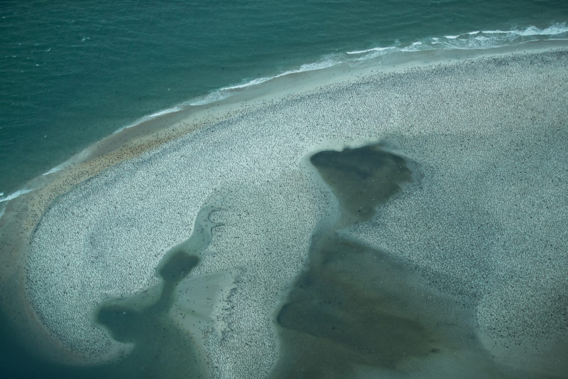
Estimating potential menhaden consumption by double-crested cormorants along the coast of North Carolina
ABSTRACT. The south Atlantic coast supports one of the highest assemblages of nonbreeding double-crested cormorants (Nannopterum auritum) known and is a convergence area for Atlantic menhaden (Brevoortia tyrannus) during the winter months. We surveyed cormorants along the coast of North Carolina and used a bioenergetics approach to estimate potential menhaden consumption. We estimated cormorant numbers using a network of repeatable aerial transects along the outer coast (366 km) and within sounds (266 km) during fall migration, winter and spring migration (2019-2021). We estimated the number of bird days, metabolic demand and menhaden equivalents of demand. Cormorant numbers peaked around 122,000 to 131,000 during southward migration, reached a low of 30,000 to 39,000 in winter and then increased to 67,000 to 68,000 during northward migration. We did not capture the peak of spring migration during the study period (20 November through 24 March). We estimated the number of cormorant days within the study period to be 8.6 x 10⁶ and 9.2 x 10⁶ for the two field seasons respectively. We estimated that cormorants consumed approximately 5,334 and 5,660 mt of menhaden equivalents within the study area. Estimated consumption peaked between 76 and 81 mt-d during fall passage and reached a low of 19 and 24 mt-d during the winter. Annual menhaden take by humans and predatory fish is around 354,000 mt. Menhaden consumption by cormorants within the study area represents 4% of the commercial and recreational take and 7% of the estimated consumption by predatory fish or 2.5% of the known take.
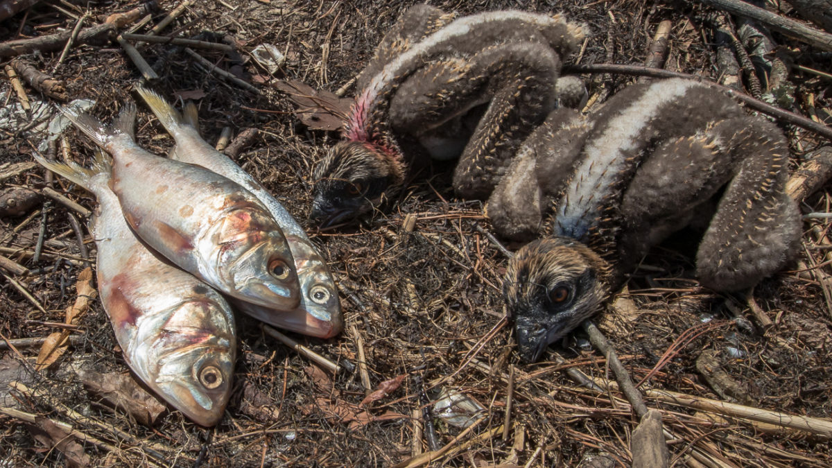
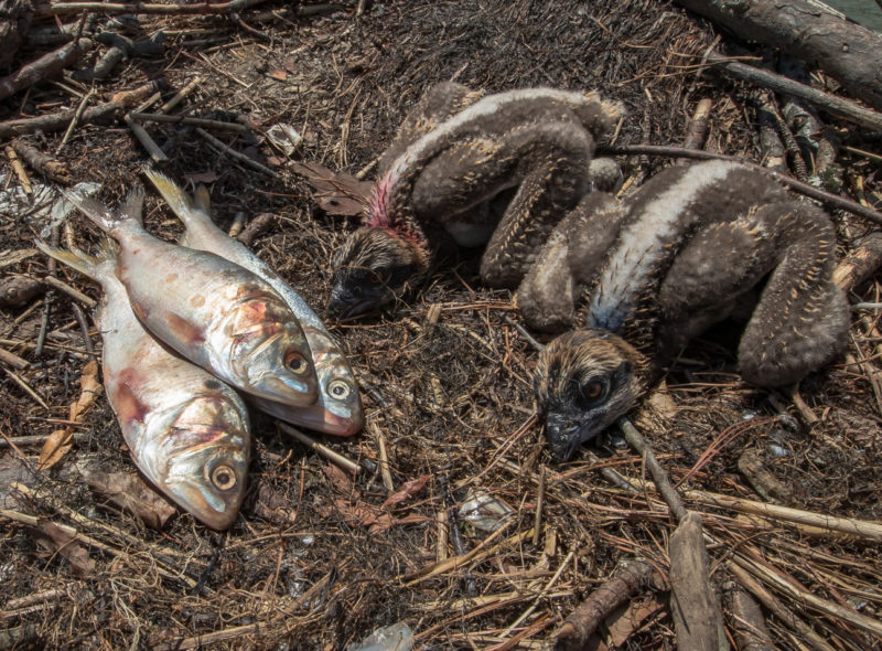
Food supplementation increases reproductive performance of ospreys in the lower Chesapeake Bay
ABSTRACT. The Atlantic States Marine Fisheries Commission (ASMFC), the governing body responsible for managing fisheries on the U.S. East Coast, formally adopted the use of Ecological Reference Points (ERPs) for Atlantic menhaden, Brevoortia tyrannus. Scientists and stakeholders have long recognized the importance of menhaden and predators such as ospreys, Pandion haliaetus, that support the valuable ecotourism industry and hold cultural significance. Landings in the reduction fishery are at their lowest levels and menhaden is facing potential localized depletion. Mobjack Bay, located within the lower Chesapeake Bay, has been a focus of osprey research since 1970 and represents a barometer for the relationship between osprey breeding performance and the availability of their main prey, menhaden. Since local levels of menhaden abundance were not available, we conducted a supplemental menhaden feeding experiment on osprey pairs during the 2021 breeding season. Our main objective was to determine if the delivery rate of menhaden had an influence on nest success and productivity. Nest success (c2 = 5.5, df = 1, P = 0.02) and productivity (b= 0.88, SE = 0.45, CI = 0.049, 1.825, P = 0.048) were significantly higher within the treatment group. Reproductive rates within the control group were low and unsustainable suggesting that current menhaden availability is too low to support a demographically stable osprey population. Menhaden populations should be maintained at levels that will sustain a stable osprey population in which they are able to produce 1.15 young/active nest to offset mortality
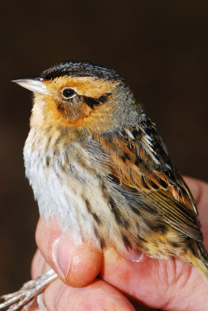
Estimating detection for salt-marsh songbirds during winter using the double-pass rope drag technique
ABSTRACT. Bird species that are restricted to tidal marshes during one or all of their life stages are under increasing pressure from sea-level rise. To date, most of the research focused on this group has been conducted during the breeding season despite the fact that more than half of the annual cycle is spent on wintering grounds and the high likelihood that the winter period is the most critical time for adult survival. We used a double-pass rope-drag technique to estimate the winter abundance of sharp-tailed sparrows (Ammospiza nelson and A. caudacutus collectively), seaside sparrows (A. maritimus) and marsh wrens (Cistothorus palustris) within tidal marshes of Virginia along 102 60X250 m transects between January and March, 2014. We used the first pass to remove birds from the transect and the second pass was used to estimate detection probabilities. The technique was highly effective producing detection rates of 98% for sharp-tailed sparrows, 95% for seaside sparrows, and 91% for marsh wrens. We conducted three rounds of surveys and found that species-specific detection rates were comparable when we restricted our analyses to two survey rounds. Availability and abundance estimates deviated to a greater degree than detection rates when restricting data to that collected during only two rounds but confidence intervals overlapped for all three taxa, regardless of which two survey periods were used for the comparison. However, results were less precise when we restricted our analyses to two of three rounds with confidence intervals averaging 13%, 45%, and 14% larger for detection, availability, and abundance respectively. The double-pass rope-drag technique provides an effective, unbiased sampling technique to estimate winter songbird abundance in saltmarsh habitat provided that at least two rounds are used and increasing the number of survey rounds will result in more precise estimates.
Citizen science photographs indicate different timing and location use of migrating adult and juvenile Whimbrels
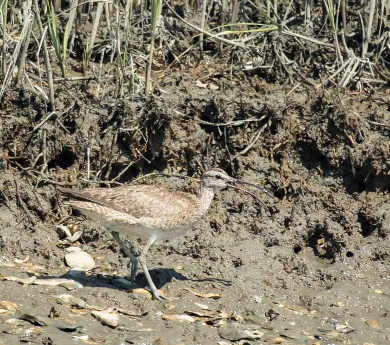
ABSTRACT. It is imperative to identify factors that influence population trends for declining species, but demographic parameters can be especially challenging to quantify for birds, such as Whimbrels (Numenius phaeopus), that breed in locations that are logistically difficult to access. At least two disjunct Whimbrel populations breed in remote and difficult to access northern latitudes but migrate through the heavily populated North American Atlantic Coast during autumn migration. Here, we capitalize on the Whimbrel migrations through the more populated coastal areas to age Whimbrels in photographs uploaded to the citizen science website, eBird, to identify the timing and location of juvenile Whimbrels staging for trans-Atlantic migratory flights. Mean photograph dates for adult migration were synchronous with reported dates for the Mackenzie Delta population that breeds along the northern coast of Northwest Territories, Canada, and stages in Atlantic Canada and for the Hudson Bay population that stages along the South Atlantic USA coast. However, the mean dates of juvenile photographs were 29–41 days later than adult dates, depending on the region. Space use by juveniles along the coast also differed from that reported for adults. Adults primarily depend on Atlantic Canada and the South Atlantic USA coast during fall migration. The percentage of juveniles was greater outside these two primary staging locations. Region-specific juvenile photograph dates suggest that juveniles may drift farther south than the majority of adults from their respective populations. The percentage of juvenile photos collected better predicted the percentage of adult photos 3 years later than 1 and 2 years later which is consistent with Whimbrel’s delayed reproductive strategy and provides validation for using photographs to obtain age ratios. As photograph uploads become more commonplace, this and similar analyses may be used to obtain information that would normally be logistically difficult with traditional field methods.
Exposure of Whimbrels to offshore wind leases during departure from and arrival to a major mid-Atlantic staging site
ABSTRACT. The United States is pursuing a diversified energy portfolio that includes offshore wind with a focus on the Atlantic Outer Continental Shelf (OCS). The Western Atlantic Flyway (WAF) supports one of the largest near-shore movement corridors of birds in the world, including several shorebird species of high conservation concern. We used satellite transmitters to examine orientation of Whimbrels (Numenius phaeopus) crossing the OCS and their overlap with two wind energy leases. Birds using a migratory staging site along the Delmarva Peninsula in Virginia crossed the OCS along a southeast-northwest axis. A considerable percentage (42.9%) of tracks intersected with one of the two wind leases. The juxtaposition to the Delmarva Peninsula placed wind leases southeast of the peninsula within both the departure and arrival trajectories of Whimbrels. The satellite transmitters used in this study were not equipped with altitude sensors, so we do not know if birds crossed wind leases within the rotor swept zone. Several species of shorebirds, including hundreds of thousands of individuals, make trans-Atlantic flights from three major staging sites: Delaware Bay, the lower Delmarva Peninsula, and Georgia Bight. All of these sites have wind leases positioned to their southeast. One of the most effective strategies for minimizing conflicts between birds and potential hazards is to place hazards away from critical movement corridors. More information is needed about departure and arrival patterns of shorebirds that cross the OCS to inform future lease placement.
Policy and the social burden of bald eagle recovery
ABSTRACT. One of the challenges of applying endangered species policy on private property is striking an equitable balance between species protection and civil liberties. The future of many imperiled species depends on a public-private trust. We estimate the social burden of managing bald eagles on private lands within the lower Chesapeake Bay (1976–2016). We quantify the area of private and government-owned land deemed critical around nests and estimate the value of private properties as an index of burden. The bald eagle population increased from 30 to 1052 breeding pairs and the land within nest buffers increased from 384 to 10,670 ha with >80% on private lands. Estimated value of private property “under guidelines” increased more than 900 fold. More than 94% of this burden was imposed after eagles reached recovery goals. Restricting activities on private lands to achieve diminishingly small conservation benefits threatens to undermine landowner participation in conservation efforts.

Large-scale distribution models for optimal prediction of Eastern black rail habitat within tidal ecosystems
ABSTRACT. Eastern black rails (Laterallus jamaicensis jamaicensis) are among the rarest and least-studied birds in North America and were recently listed as threatened under the U.S. Endangered Species Act. Spatial models that predict habitat quality across the subspecies range are therefore needed to inform conservation, recovery, and monitoring efforts for this rare bird. We used data from 47,585 call-broadcast surveys collected at 7906 sites over a 3-decade period (1990s, 2000s, 2010s; 23 total years) to build species distribution models for eastern black rails. We used hierarchical Bayesian occupancy models and predictive model selection to develop multi-scale models that optimally predict habitat suitability for eastern black rails within tidal wetlands while also accounting for imperfect detection of these cryptic birds during field surveys. We also used raster regression techniques to translate model predictions into 30-m resolution maps of habitat suitability for eastern black rails within tidal wetlands along the eastern seaboard of the United States. The model predicted suitability of breeding habitat as a function of wetland attributes (e.g., cover of high marsh and terrestrial border), hydrologic modification, and disturbance from human development measured over multiple spatial scales. We also found differences in habitat relationships for eastern black rails when compared to models that included both North American subspecies of black rail. Important results included negative effects of shrub-scrub wetlands, and strong positive effects of high marsh, terrestrial border, and impoundments on breeding season occupancy. Our study provides an example of integrating detection-non-detection data and modern statistical methods to build predictive distribution models for an extremely rare species, while also providing rigorous predictions of breeding habitat quality for the eastern black rail within tidal wetlands. These models will facilitate optimal monitoring, habitat conservation, and recovery planning efforts for eastern black rails and provide a foundation for future research and conservation of this imperiled bird.

