Grace Flies to Mobjack Bay – Virginia July 3, 2015
July 6, 2015Virginia Red-cockaded Woodpeckers finish season by fledging 21 young birds
July 7, 2015
Information is the one lasting contribution that science makes to society. Information is also the common thread that joins all of the diverse disciplines of conservation biology together. The primary focus of The Center for Conservation Biology is the collection, interpretation, and dissemination of information that is central to solving today’s environmental problems. We believe that information is vital to effective conservation and we are committed to meeting the information needs of an expanding community of end users.
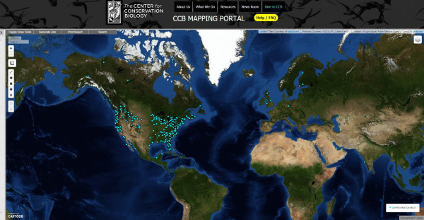
In 2009, The Center launched the Virginia Bald Eagle Nest Locator, an online platform that allows users to interact with up-to-date eagle survey results. Due to regulatory requirements, this data resource is in high demand and making the information available online has improved and streamlined the permitting process. This application receives more than 20,000 visits per year. To learn more about the bald eagle annual survey, or to interact with survey data, visit the Eagle Nest Locator data in the Mapping Portal.
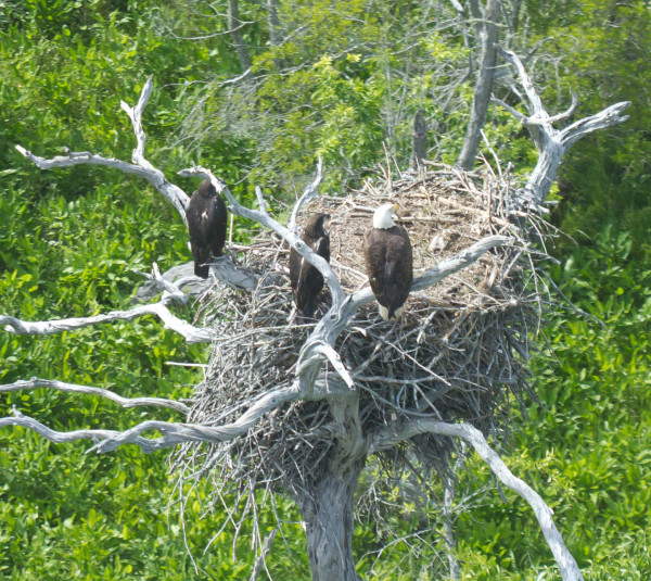
An adult bald eagle hangs out near the nest with two 10-wk old chicks along the James River. The Eagle Nest Locator, which displays data from the bald eagle annual survey, is available with new tools on the CCB Mapping Portal. Photo by Bryan Watts.
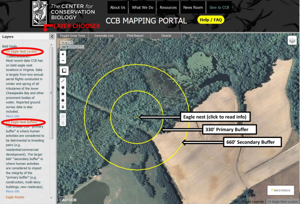
Example of the Eagle Nest Locator, including the primary and secondary butter areas.
Responding to the conservation community, The Center has added new features to the Eagle Nest Locator. Beginning in early 2015, The Center requested assistance from AidData (a group with tremendous technical capacity that provides geo-referenced data focused on global aid) to update the features and offerings of the Mapping Portal. Some notable upgrades include: a substantial distance and area measuring tool, a “Generate Link” button that saves the current map view in the URL bar so that you can bookmark or share it with others, a “Print Report” button that generates a one-page report pdf file, and a set of Draw Tools that allow you to add your own lines, shapes, and markers. You can learn more about the new Mapping Portal features on the Mapping Portal FAQ page.
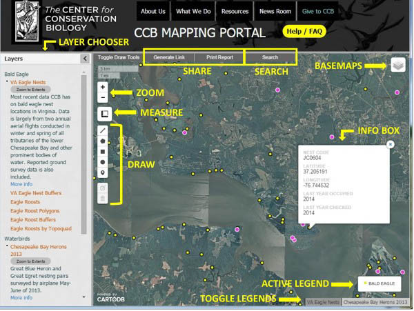
Main components of the CCB Mapping Portal.
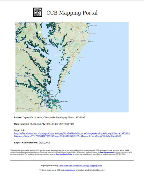
The “Print Report” tool creates a one-page pdf file that includes the current map view, the current active legend, the names of all active layers, the coordinates of the map center, the date the report was generated, and a link to map at the time the report was generated.
In addition to several new applications, CCB is providing an expanded list of data resources to the Mapping Portal including the National Eagle Roost Registry and recent Colonial Waterbird Surveys. Communal roosts used by bald and golden eagles are locations where numerous eagles spend the night. Roosts are federally protected from disturbance, and the Mapping Portal provides information for regulators by showing roost centroids, polygons, primary/secondary buffers, and a topographic map. Waterbird species are also represented in the Mapping Portal, with layers for the 2003, 2008, and 2013 Colonial Waterbird Surveys. All of these surveys have systematically covered all 24 species of colonial waterbirds throughout the Coastal Plain province of Virginia, and allow for the development of conservation strategies for these sensitive populations. Layers for ongoing citizen science projects OspreyWatch and the U.S. Nightjar Survey have also been added. Stay tuned for newly added data layers!
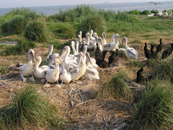
Brown pelican and double-crested cormorant chicks on Smith Island in the upper Chesapeake Bay. Both pelicans and cormorants are counted in the CCB colonial waterbird surveys. Surveys from 2003, 2008, and 2013 are currently available to view in the Mapping Portal. Photo by Bryan Watts.
The OspreyWatch layer shows a live feed from the OspreyWatch.org website, where users around the globe contribute osprey breeding data.
Written by Marie Pitts | mlpitts@wm.edu | (757) 221-7503 &
Bryan Watts | bdwatt@wm.edu | (757) 221-2247
July 6, 2015