Camellia Remains at Nanney’s June 14
CCB to investigate shorebird mortality
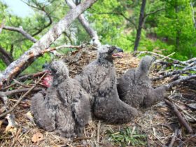
June 13, 2013Urban Raised Juvenile Bald Eagles Fledging
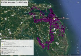
June 14, 2013Fishing must be good at Nanney’s Creek. Camellia is still there as of this morning. Other than a couple brief flights he has remained there the past three days. He knows how to fish the farm ditches. His data points are – WHITE arrow June 11 at 5:00am, DARK BLUE June 11 at 8:00am, PINK pointer June 11 at 2:00pm, GREEN pointer June 12 at 1:00am, BLUE pointer June 12 at Noon, ORANGE pointer June 13 at 1:00am, PURPLE pointer June 13 at 4:00pm, and as of this map WHITE arrow June 14 at 1:00am. Click on maps to enlarge.


3 Comments
Reese in the last map up date Jodi had spotted an eagle around Pungo Bridge a few times..she gave time an dates..was this Cam?
Response – As the current map shows, Camellia stayed close to Nanney’s Creek and Mill Landing Rd. Pungo Ferry Bridge is a few miles to the south west, so could not have been Camellia that Jodi was seeing.
All I am going to say is … What a Stinker! We’ll be back.
Here I thought Camellia was an urban eagle, but it looks like he’s a farm boy after all.