Mapping bald eagle movement corridors in the Northeast
Citizen scientists work to fill the nightjar information gap
September 26, 2016
GSM/GPS Transmittered Bald Eagle Locations 9/21/2016
September 27, 2016
Well before Europeans began to arrive in the new world, people living within the Chesapeake Bay marked the fall arrival of bald eagles into the Bay. The number of birds begins to swell in November and reaches a peak early in the year, only to decline again in March. With the advent of broad-scale banding in the 1930s and 1940s, we began to recognize that the fall birds were from northern populations. However, we have never known anything about the routes that birds use to move between northern breeding grounds and their winter home in the Chesapeake. In truth, we have had no real reason to identify these routes until now.

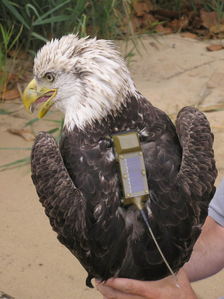
Fourth-year eagle with transmitter. Eagles were tracked back and forth between the Chesapeake Bay and northern summer areas. Photo by Libby Mojica.
With the establishment of many commercial-scale wind installations throughout the eastern United States and Canada has come a growing concern about the potential impact to migrating eagles. Raptor migration corridors form around narrow ridgetops and coastlines that produce updrafts the birds use to facilitate soaring and gliding. These same sites support the best wind profiles for commercial wind power generation. Development of turbine fields within migration routes has the potential to cause population-level impacts. One of the most effective strategies for reducing eagle and other raptor mortalities is to place turbines away from areas of high activity. An impediment to implementing this strategy has been our inability to identify movement corridors.

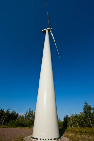
Commercial-grade wind turbine in eastern North America. To build the green energy economy, thousands of similar turbines have been installed over the past decade. Photo by Bryan Watts.
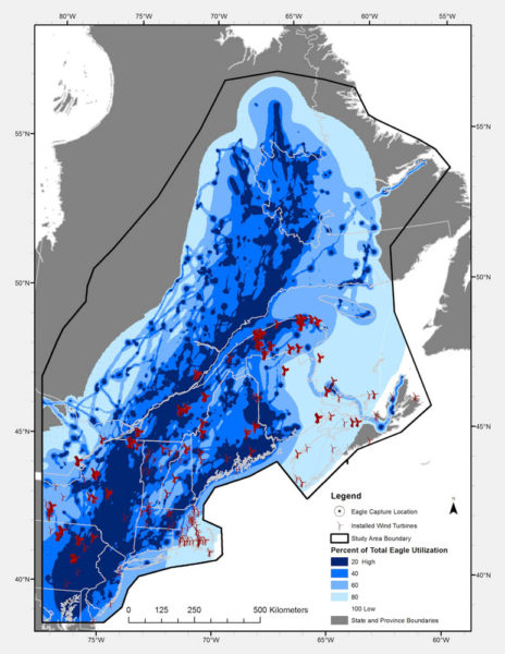
In a recent paper published in Plos One, CCB biologists used satellite tracking data to delineate eagle migration corridors in the Northeast and overlay these corridors on maps of existing wind facilities and areas of viable wind-energy development. A dynamic Brownian bridge movement model was used to process 132 individual migration tracks to create a utilization surface that delineated the movement corridors. The work was funded by the American Wind Wildlife Institute and the U.S. Fish and Wildlife Service with the intent of informing the placement of future wind facilities in the Northeast.

Map of bald eagle migration corridors in the Northeast as determined by CCB biologists using satellite tracking data and Brownian bridge modeling. Data from CCB.
Bald eagles from the north that winter in the Chesapeake Bay use two movement corridors, including an inland and coastal route. The inland route is 2,175 kilometers (1,350 miles) long and extends from the Chesapeake north across the Appalachians to the St. Lawrence River and ends in Quebec and western Labrador. The coastal route is 1,620 kilometers (1,010 miles) long and extends along the coast through Connecticut, Massachusetts, New Hampshire, and Maine through New Brunswick and up to the Gaspe Peninsula in Quebec.

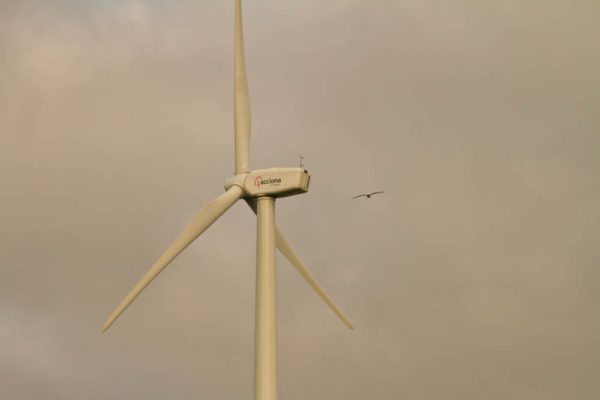
An osprey flies close to a wind turbine in eastern Canada. Placing turbines away from major flight lines is a key strategy to reduce raptor mortality. Photo by Bryan Watts.
Delineation of the movement corridors will be important for future wind development. More than 2,000 existing wind turbines were within the highest two categories of eagle use. However, only 6% of the area supporting the most commercially viable wind power classes overlapped with these eagle use areas, suggesting that a great many locations exist where wind may be captured outside of eagle movement areas.
Written by Bryan Watts | bdwatt@wm.edu | (757) 221-2247
September 27, 2016
