Camellia Visits Wards Corner – Norfolk 12/12 2014

Grace Remains at Dare County, NC 12/10/2014
December 12, 2014
Grace Flies to Pocosin Lakes NWR 12/14/2014
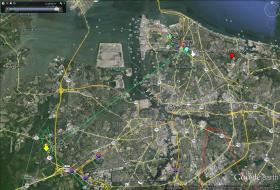
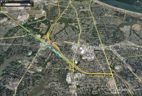
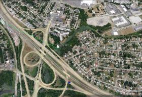
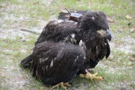
December 15, 2014Once again the solar battery that powers the satellite transmitter that Camellia is wearing did not send data for Dec 11 and parts of Dec 10 and 12. However, the sun was out yesterday so we know where Camellia is as of this satellite map. Camellia was in the Jolliff area of Chesapeake (YELLOW arrow Dec 10 5pm) and off I-564 at the Norfolk Naval Base at Noon Dec 12 (GREEN pointer), after a brief stop at the very busy shopping area known as Wards Corner (PINK pointer Dec 12 10am). As of this map Camellia is at the intersection of I-64 and Tidewater Dr (WHITE arrow Dec 12 at 5pm). Click on maps to enlarge.



2 Comments
Went to Greenbrier area yesterday morning around 11:00..saw an adult eagle flying over head near the mall..thought it might be you Cam..guess not..beautiful sight anyway..Thanks Reese
Please stay out of trouble, Cammie! Reese, you’re the best!